In a recent honours project, Joe Rosetti and myself have applied the hedonic market approach to put a monetary value on urban green space in Australia.
We first compiled a dataset of over 2,531,803 residential property transactions across mainland Australia over the period 2000-2010. The dataset contained information about the transaction date, the location of the property, the sales price as well as a standard set of attributes (number of bedrooms, bathrooms, area, car parks etc.).
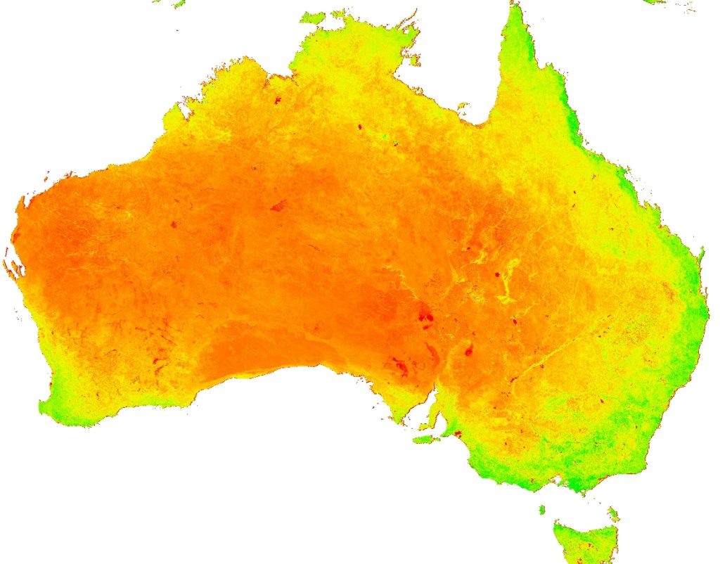
To measure the amount of urban green space in the vicinity of each property, we used satellite imagery measuring the Enhanced Vegetation Index (EVI). EVI measures the amount of photosynthesis occurring in an area and can therefore be used as a proxy for a measure of green infrastructure. The data is derived from the NASA satellite images obtained from Terra and Aqua Moderate Resolution Imaging Spectroradiometers (MODIS), the MOD13Q1. MOD13Q1 is the product composites 16 of sequential days of MODIS satellite data into a single image.
Our results suggest that increasing the amount of green space by a one standard deviation led to an increase in house prices of between 8.62% and 15.57% ($32,139 to $57,991 for the average house). In other words, if green space equivalent to a 440 acre park (which is roughly one standard deviation) was introduced to a typical suburb, the benefit of this would be valued by residents and prospective home buyers at $32,139 – $57,991 per property.
The results of our study have also been used by a recent Parks Victoria report on Valuing Victoria’s Parks.
- Download the honours thesis here.
- The underlying 2012 EVI data for Australian Logcal Government Areas (LGAs) can be accessed here.
Photo credit:
- https://www.broadsheet.com.au/melbourne/entertainment/article/trees-return-your-emails
- https://www.jelliscraig.com.au/